Utility Locating

Utility Locating Services in Queensland

Utility locating services are used to locate and mark underground utility lines and other infrastructure, such as gas, water, and electrical lines, prior to digging or construction.

CSA Specialised Services provides utility locating and mapping services in Queensland to detect, trace and map underground pipes, gas lines, sewer assets, stormwater drains, telecommunications and electrical infrastructure.

Our utility locating and infrastructure services include:

  • Underground utility mapping
  • Ground Penetrating Radar (GPR)
  • Utility design
  • Utility coordination
  • Utility surveying
  • Asset management
  • Subsurface Utility Engineering (SUE)

Our utility mapping team provides services for a range of project requirements, from early planning through to surveys after construction. Our underground utility surveys use mapping technology to provide a comprehensive survey of the site. By determining the location and condition of underground infrastructure, we can prepare a comprehensive report of the area. This information supports planning and work before and during excavation, helping to minimise the risk of damage to vital underground infrastructure.

Our utility locating and subsurface utility engineering work is carried out in accordance with the applicable requirements of AS 5488.1:2022 and AS 5488.2:2022.
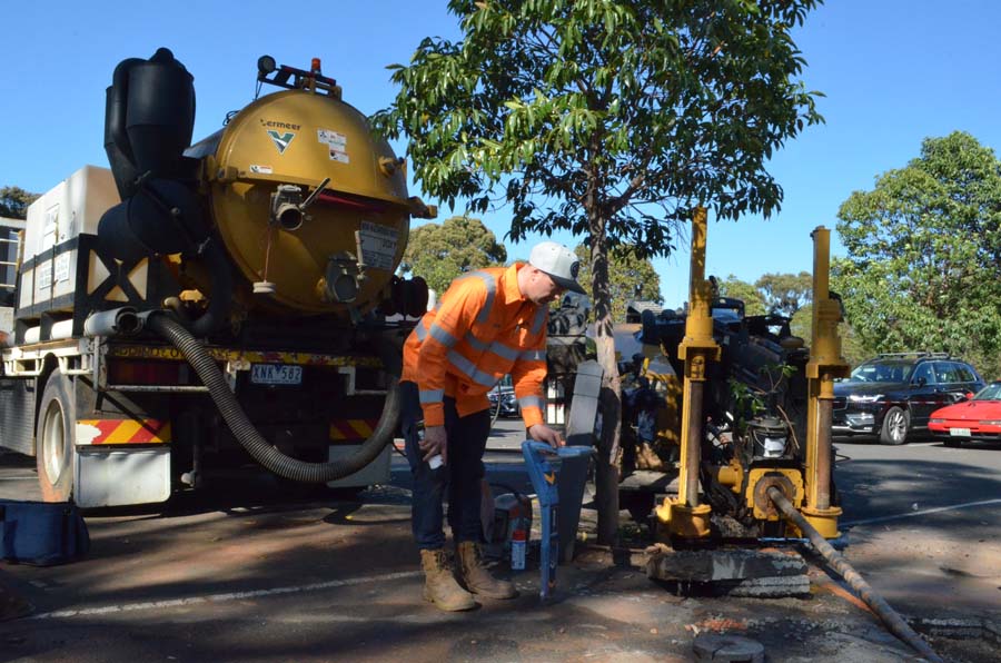

Underground utility locating services

We provide our clients with the assurance to plan, build, and manage their projects

Utility Locating and Infrastructure Services

UNDERGROUND UTILITY MAPPING

Underground utility mapping is the process of locating and mapping underground utilities and infrastructure before digging or construction. It helps reduce the risk of damage to utilities and supports the safety of workers and the public. CSA Engineers specialises in providing Subsurface Utility Engineering (SUE) services, including underground utility mapping.

Ground Penetrating Radar (GPR)

Ground penetrating radar (GPR) uses electromagnetic waves to collect information about underground utilities and other subsurface features. Reflected signals are analysed to help determine their location and depth. GPR is non-invasive and can be used to locate utilities without the need for excavation or other destructive methods.

Utility Design

Utility mapping design is an important step in the construction process, as it helps to ensure that new projects are planned and executed safely and efficiently, minimising the risk of utility damage and other issues. It is also important for maintenance and repair work, as it helps to accurately locate and identify utilities that need attention.

Utility Coordination

By working together and coordinating the installation, maintenance, and repair of underground utilities and infrastructure, we can help to minimise the risk of damage to the utilities, reduce the need for costly redesigns, and improve the overall safety and reliability of the infrastructure.

Utility Surveying

Utility surveying provides accurate and reliable information about the location and condition of underground utilities, helping to prevent damage during construction or excavation and support the safety of workers and the public. We provide the findings of our investigations in a range of working file formats.

Asset Management

Asset management is an important aspect of infrastructure management and maintenance. Accurate asset location can support safer planning for excavation. CSA Engineers provide asset management services that include the collection of utility asset inventory data. Our trained field crews have the knowledge and experience to access confined spaces, gather pipe sizes and invert measurements, and collect other asset inventory information.

Subsurface Utility Engineering (SUE)

Subsurface Utility Engineering (SUE) is a professional practice and a set of standards for the collection, interpretation, and management of information about subsurface utilities and underground infrastructure.


CSA Engineers specialises in providing SUE. Combined with adherence to relevant industry standards, this enables the team to provide accurate and reliable subsurface utility information that helps minimise the risk of damage to underground utilities during construction, reduce the need for costly redesigns and improve the overall safety and reliability of infrastructure.

Our work also follows applicable health and safety standards and regulations to support safe delivery and compliance with relevant requirements.

Benefits of Utility Mapping

Utility mapping creates a map showing the location and type of underground utilities, such as water and gas lines, electrical and telecommunications cables, and sewage and stormwater systems. Key benefits of utility mapping include:

  • Turning potential unknowns into known information and reducing uncertainty
  • Reducing the need for unnecessary digging through non-invasive locating methods
  • Supporting the collection of as-built data
  • Helping reduce avoidable project costs associated with utility-related issues
  • Minimising downtime caused by unexpected issues and lengthy delays

Need Help With Utility Locating?

Take a few minutes and send us your requirements
we will be back with a solution.

Underground utility locating services
TOP